GEOTECHNICAL ENGINEERING1
GLOUCESTER
HomeGeophysicsElectrical resistivity / VES (Vertical Electrical Sounding)

Electrical Resistivity Testing & Vertical Electrical Sounding in Gloucester

Practical geotechnics, field-tested.

LEARN MORE

Specifying a foundation depth in Gloucester without understanding the clay-sand interfaces beneath the alluvium is a gamble that backfires when differential settlement appears. The Severn Vale's Quaternary deposits hide buried channels and variable water tables that boreholes alone miss. Electrical resistivity testing maps these transitions across the entire site before a single excavation starts. Vertical Electrical Sounding (VES) delivers a continuous resistivity profile with depth, pinpointing soft zones, gravel lenses, and the bedrock surface without the gaps inherent in point-source investigations. For projects near the Severn's historic floodplain, where paleochannels shift groundwater flow unpredictably, combining resistivity with test pits provides the ground-truthing needed to calibrate the geophysical model. Our surveys follow BS 5930:2015+A1:2020 procedures and are processed by geophysicists who understand the Lias Clay and River Terrace Deposits that define Gloucester's subsurface.

A VES profile across Gloucester's alluvium can distinguish between a 2-metre gravel lens and a 6-metre paleochannel infill—two features that look identical in a single borehole log but demand entirely different foundation solutions.
Our service areas

How we work

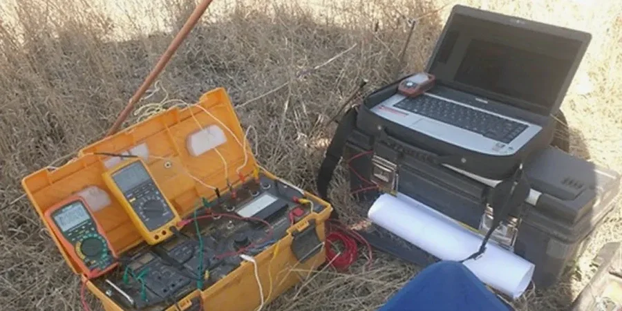
Gloucester sits on a complex sequence of Charmouth Mudstone overlain by Quaternary alluvium and river terrace gravels—a layering that creates sharp resistivity contrasts ideal for VES interpretation. The Lias Clay typically reads below 30 ohm-m, while dry gravels exceed 200 ohm-m, making the interface unmistakable in processed profiles. We run Schlumberger arrays with current electrode spacings up to 200 metres, achieving investigation depths beyond 40 metres where needed for deep basement assessments. Data inversion uses RES2DINV software with topography correction for the gentle slopes toward Robinswood Hill. For contamination mapping on former industrial land along the Gloucester Docks corridor, 2D resistivity tomography identifies leachate plumes at 5 to 15 metres depth before they reach the underlying aquifer. When site conditions require mechanical properties alongside resistivity, a CPT test can verify the stratigraphic boundaries the geophysics suggests, and for road schemes near the A40, the CBR test translates subsurface conditions into pavement design parameters.
Electrical Resistivity Testing & Vertical Electrical Sounding in Gloucester
Technical reference — Gloucester

Local geotechnical context

BS EN 1997-2 (Eurocode 7, Part 2) requires that ground investigation scope be sufficient to identify variability in ground conditions across the site. In Gloucester, relying solely on boreholes spaced at 25-metre centres risks missing a thin, water-bearing gravel layer at 4 metres depth—a scenario we have documented on sites east of the railway line where alluvial architecture changes laterally over less than 15 metres. A resistivity survey costs a fraction of the foundation redesign that follows an undetected soft zone. For projects involving deep excavations in the Lias Clay, where weathering profiles vary sharply across the site, the resistivity data feeds directly into the slope stability analysis, defining the depth of the weathered zone that controls cut-slope geometry. Missing this step leaves the ground model incomplete, and the residual risk sits with the contractor.

Need a geotechnical assessment?

Reply within 24h.

Email: contact@geotechnical-engineering1.com

Explanatory video

Applicable standards

BS 5930:2015+A1:2020 – Code of practice for ground investigations, BS EN 1997-2:2007 – Eurocode 7: Geotechnical design – Ground investigation and testing, BS 1377-3:2018 – Methods of test for soils for civil engineering purposes – Part 3: Chemical and electro-chemical testing

Typical values

ParameterTypical value
Array configurationSchlumberger (standard), Wenner (horizontal resolution)
Maximum investigation depth40–60 m (AB/2 = 200 m)
Typical resistivity range (Lias Clay)15–35 ohm-m (saturated)
Typical resistivity range (Terrace Gravels)80–600 ohm-m (dry to saturated)
Electrode spacing incrementLogarithmic, 1.5 m minimum
Data processing standardBS 5930:2015+A1:2020, Section 5
Output deliverables1D sounding curves, 2D pseudosections, 3D resistivity models

Frequently asked questions

How deep can a VES survey investigate in Gloucester's geology?

With a maximum current electrode half-spacing (AB/2) of 200 metres, we typically achieve investigation depths between 40 and 60 metres in Gloucester's alluvial and Lias Clay sequences. The practical limit depends on site access—we need clear runs of 300 to 400 metres for the full spread. For shallower targets, such as mapping the gravel-clay interface at 4 to 8 metres, a smaller array is faster and equally effective.

What does an electrical resistivity survey cost in Gloucester?

For a typical Gloucester site investigation, VES and 2D resistivity surveys range from £450 to £930 depending on the number of soundings, line length, and processing requirements. A single VES point with interpretation starts toward the lower end; a full 2D tomography line with topographic correction and report approaches the upper end. We provide fixed-price quotations after reviewing your site plan.

How does weather affect resistivity survey results in the Severn Vale?

Surface moisture after rain improves electrode contact and reduces contact resistance, which is generally beneficial. However, saturated near-surface conditions can mask deeper resistivity contrasts. We schedule surveys with consideration to recent rainfall and include weather notes in our reports. Winter surveys in Gloucester's clay-rich soils often produce excellent data because the clay matrix holds consistent moisture content.

Can resistivity testing distinguish between Lias Clay and river gravels?

Yes, and this is one of the most useful applications in Gloucester. Saturated Lias Clay typically registers 15 to 35 ohm-m, while dry to moist River Terrace Gravels range from 80 to over 600 ohm-m. The contrast is sharp enough that the gravel-clay interface appears as a clear inflection in the resistivity-depth curve, allowing us to map the thickness of alluvial cover across a site with confidence.

Do you combine resistivity with other investigation methods?

We routinely recommend calibrating resistivity profiles with at least one or two boreholes or test pits. The geophysics identifies the lateral extent of features; the physical investigation confirms what those features are. For Gloucester sites, we often pair resistivity with CPT soundings for continuous mechanical data, or with laboratory testing of recovered samples to correlate resistivity values with specific lithologies.

Location and service area

We serve projects in Gloucester and surrounding areas.

View larger map