GEOTECHNICAL ENGINEERING1
GLOUCESTER
HomeUnderground ExcavationsGeotechnical excavation monitoring

Geotechnical Excavation Monitoring in Gloucester: Precision for Deep Works

Practical geotechnics, field-tested.

LEARN MORE

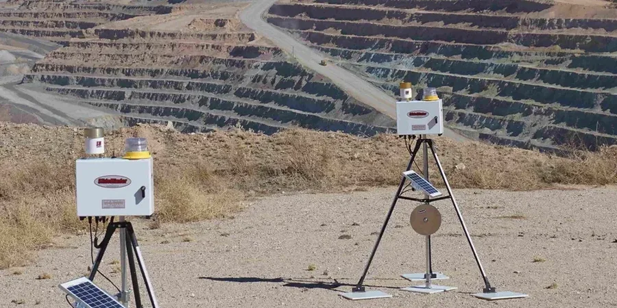
The first thing the crew wheels onto a Gloucester site is usually the total station—a robotic instrument that tracks prisms fixed to shoring walls and surrounding buildings. It never blinks. In a city built on the transition between Cotswold limestone and the soft alluvium of the Severn Vale, ground behaviour can change within 20 metres of face advance. That is why monitoring here is not a box-ticking exercise; it is an active risk-control loop. We link surface settlement points, borehole inclinometers, and standpipe piezometers into a single dashboard that updates every 30 minutes. For deep basement work near Gloucester Docks—where historic quay walls and saturated made ground demand an extra layer of vigilance—we often combine the monitoring programme with a CPT test campaign to define the soft clay layers before shoring design is finalised.

Gloucester’s mix of historic quay structures and soft Severn alluvium demands monitoring that catches movement before it becomes a claim.

Our service areas

How we work

The soil contrast between two Gloucester postcodes tells the whole story. In GL1, close to the cathedral and the River Severn, you are digging through water-bearing gravels and soft silts where pore pressure can spike after a rainfall event. Move east into GL4 around Robinswood Hill and you hit stiff Jurassic clay and limestone brash that stands up well in the short term but relaxes slowly, shedding load onto temporary works over weeks. Our monitoring setup adjusts to both scenarios: vibrating wire piezometers in the saturated gravels track hydraulic equilibrium, while in-place inclinometers in the GL4 cuttings measure creep displacement at millimetre scale. For sites where trench stability is a precondition, the data feeds directly into the temporary works design alongside parameters from test pits logged at the same formation.
Geotechnical Excavation Monitoring in Gloucester: Precision for Deep Works
Technical reference — Gloucester

Local geotechnical context

Gloucester sits in a meteorological sweet spot that is not always sweet for excavation: the Severn Valley funnels moisture-laden air from the Bristol Channel, delivering persistent drizzle that keeps the ground profile saturated. That changes the risk profile fast. A silty sand that looked competent during a dry week can lose effective stress within 48 hours of sustained rain, and a propped excavation that was barely moving can start creeping toward the highway. We have seen this exact sequence play out on sites near the A430 corridor, where a 6-metre cut triggered settlement in an adjacent brick terrace simply because pore pressure was underestimated. Our trigger levels are calibrated to Gloucester’s climate reality—not a generic textbook—and we escalate verbally before the morning report even lands in your inbox.

Need a geotechnical assessment?

Reply within 24h.

Email: contact@geotechnical-engineering1.com

Applicable standards

BS 5930:2015+A1:2020 (Code of practice for ground investigations), BS EN 1997-1:2004+A1:2013 (Eurocode 7: Geotechnical design – General rules), CIRIA C760 (Guidance on embedded retaining wall design), BS 1377 (Methods of test for soils for civil engineering purposes)

Typical values

ParameterTypical value
Monitoring frequency (active phase)Every 30 min via AMTS / manual readings twice daily
Inclinometer accuracy±0.25 mm/m (in-place MEMS sensors)
Piezometer range0–350 kPa (standpipe & VWPW types)
Settlement point density1 per 10 m² in sensitive zones
Trigger thresholds (alert)Typically 10 mm displacement or 70% of design load
Reporting formatDaily PDF + real-time web portal
Geodetic controlOSGB36 with local benchmarks tied to Ordnance Survey

Frequently asked questions

What does geotechnical excavation monitoring cost for a typical Gloucester site?

A basic programme with manual inclinometer and piezometer readings plus a weekly total station survey usually runs between £570 and £1,940 per month, depending on the number of instruments and reading frequency. Automated 24/7 systems with real-time alarms sit at the higher end of that range but often reduce the need for full-time site supervision, so the net project cost can actually drop.

How quickly can you mobilise monitoring equipment in Gloucester?

Most standard kit—standpipe piezometers, settlement plates, survey prisms—can be on site within three working days. Specialist vibrating-wire instruments or in-place inclinometer strings may need five to seven days if calibration against UKAS-traceable standards is required. We keep a stock of common sensors in the South West precisely for short-notice Gloucester starts.

Do you monitor groundwater levels in the Severn alluvium?

Absolutely. The alluvial deposits along the Severn corridor hold perched water tables that can change overnight with river stage and rainfall. We install standpipe piezometers in the granular layers and, where response time matters, vibrating-wire piezometers that log automatically. The data feeds into the temporary works designer’s assessment of basal stability and seepage forces.

Can you integrate your monitoring data with our BIM or project management platform?

The reference range for this service in Gloucester is £570 - £1.940. The final price depends on the project scope and volume.

Location and service area

We serve projects in Gloucester and surrounding areas.

View larger map